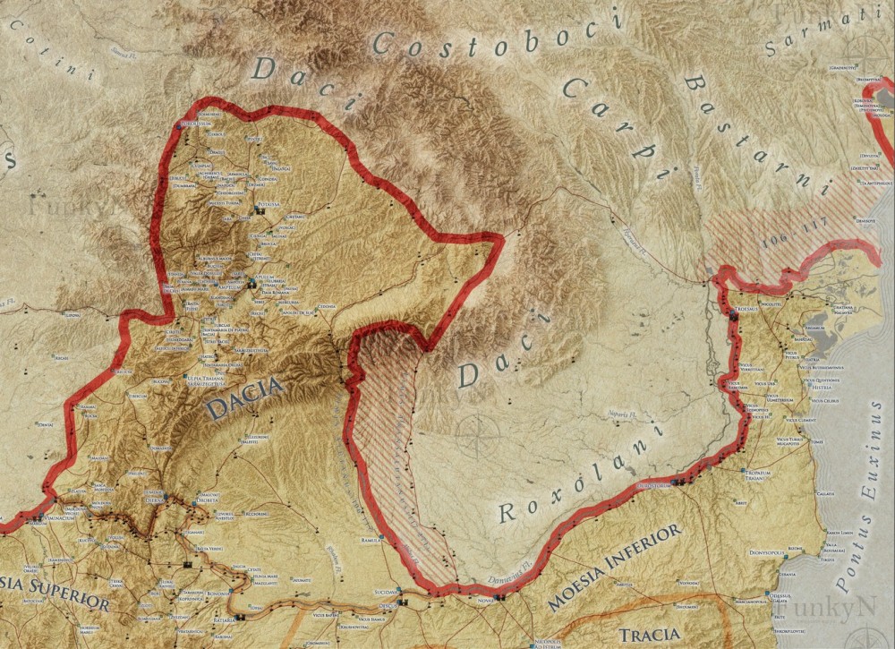
We are continuing our series of studies regarding the topography of Roman Dacia with this short note regarding the route of the Roman road which connected Drobeta with Ulpia Traiana Sarmizegetusa. The analysis of new archaeological data, combined with the research of the cartographic documentation, lead to some important information which allows us to reconstruct the route of this road. The road reaches several current villages, starting from Drobeta, continuing towards Halânga, Puţinei, Malovăţ, Lazu, Cocorova, Şişeşti, Cărămidaru, Peşteana, Stroeşti, Dealu Viilor, Câmpu Mare, Cătunele, the hill Comorâştea, Vârtopu, Pinoasa, Dâmbova, Cârbeşti, Drăguţeşti, Iaşi-Gorj, Romaneşti, Târgu Jiu, Turcineşti, Sânbotin şi Gornicel, Bumbeşti-Jiu, Pleşa, Crevedia, Merişor, Crivadia, Petros, Baru, Livadia, Pui, Galaţi, Ruşor, Băieşti, Subcetate, Sântămăria Orlea, Vadu, Pâclişa, Cârneşti and Ostrov. By accurately mapping the route of the Roman road, we provide a useful tool for the protection of this important Roman landscape element.
Source: Fodorean F. (2021). Mapping Roman Dacia. Several data regarding the Roman road connecting Drobeta with Ulpia Traiana Sarmizegetusa. Journal of Ancient History and Archeology. 8(3): 156-166
Source web-site: http://jaha.org.ro/index.php/JAHA/article/view/664/440
Number of views: 2185