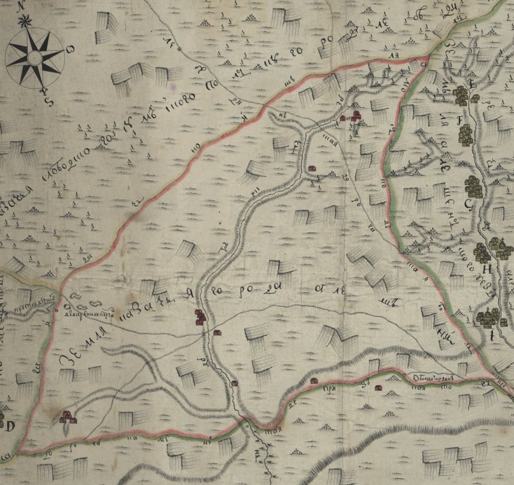
The article is devoted to the reconstruction of one of the sections of the Sagaidachnyj road, which ran from the town of Oboyan to the border of the Polish-Lithuanian Commonwealth and the Muscovite Kingdom in 1647, mainly along the territory of the Putivl district. To solve this problem, documents of the middle of the 17th — 18th centuries were involved in which there are references to this road. Mostly these are legal documents related to the receipt of land plots of the first settlers in the territory of Slobozhanshchina. An important landmark Sagaidachnyj road is often found in defining the boundaries and location of the land. In addition, a previously unknown plan of the city of Aleshnya was recently introduced into scientific circulation, on which this road is clearly indicated. This made it possible with a high degree of probability to localize its location in the 17th — 18th centuries on the ground. To determine the places of crossings, the data contained in the documents related to the organization of the border service of the Moscow kingdom at the end of the 16th — 17th centuries were used. The name of this road is associated with the campaign of Hetman Pyotr Sagaidachny to Moscow.
Source: Osadchij E. M., Degtyarev S. I. (2021) Sagaydachny Road: from the top of the Psel river to the border of the Polish-Lithuanian commonwealth. Ancient Sumy Land. №LIX: 5-20
Number of views: 3063