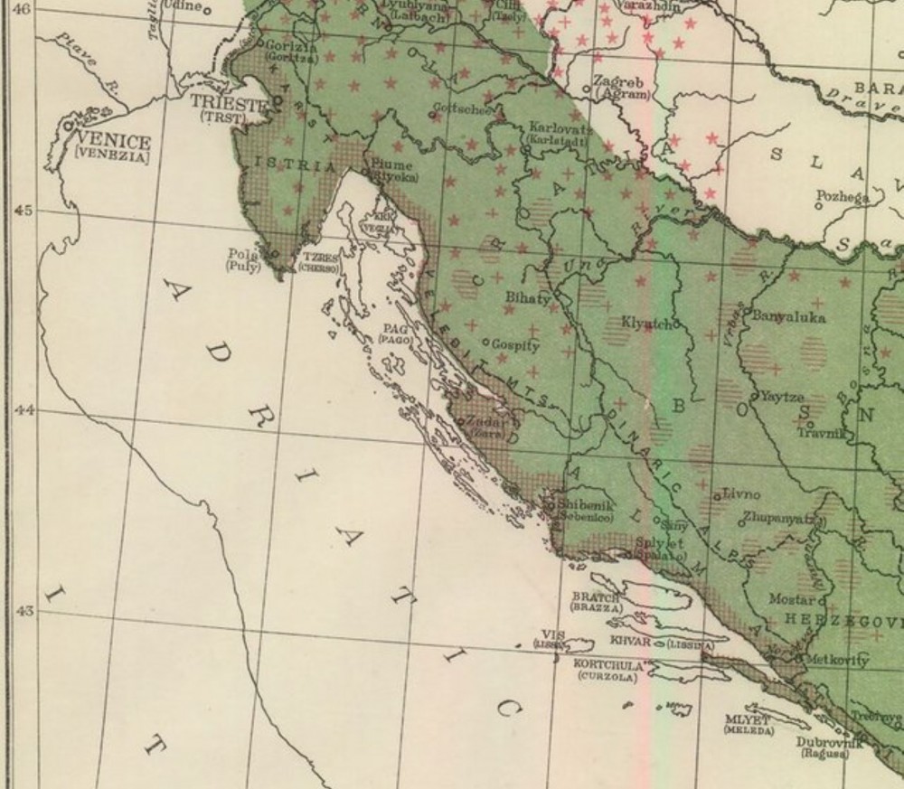
This article analyses the relationship between charted (drawn) maps and mental maps of the contested border-region between Italy and Yugoslavia following the First World War. Drawing upon graphic and verbal depictions of tourist routes, railways, supply chains, demographics, topographic features and telephone and telegraph lines, the article analyses representations of an unstable border at a moment of peak uncertainty. In so doing, it reveals the centrality of architects, engineers, tourist bureaus, artists and cartographers in forging an imaginary geography that correlated with emerging political divisions in post-war Europe. On both sides of the contested border, cartography was utilised to change the way people conceived political geography. Maps, the article argues, both revealed existing mental maps and helped to shape new ones.
Source: Worsnick M. (2022). Mapping the Margins: National Borders, Transnational Networks and Images of Coherence in Interwar Italy and Yugoslavia. Contemporary European History. 31(1): 48–70
Number of views: 2531